Description
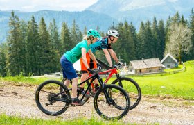
The Sonnbrand Alm route offers a top-class MTB experience! Starting leisurely on asphalt, over a long and partly steep gravel ascent to the highest point with a breathtaking 360° panoramic view of the Gesäuse and the Ybbstal Alps, past two rustic alpine huts offering the best regional products for refreshment, through the cows on a narrow single trail, and finishing with a fast downhill including sections in the bike park.
MTB heart, what more do you want!
Starting point of the tour
Hollenstein, village center
Destination point of the tour
Hollenstein, village center
Route description Sonnbrand Alm route Hollenstein/Ybbs
Starting point in the village center of Hollenstein/Ybbs, along the romantic Hammerbach valley, always gently ascending into the NÖ-Eisenwurzen Nature Park, past the Treffengut and Wentsteinhammer (relics from the hammer forging era, rest stop and historical site) steadily uphill past the old hunting lodge Sandgraben up to the fork in the road at Promau (at km 9.5), straight on now on a forest road past a large wildlife feeding station to the Kitzhütt road junction (the Kitzhütten Alm route continues straight here), turn right into Sonnbrand Street along the south side of Königsberg, past woodcutters' and hunting huts with views of Hochkar, Dürrenstein, and the Ötscher area up to the Garnstatt junction (at km 21.1).
Now follows a sweaty climb to Siebenhüttenalm (operated from June to September), where you can enjoy a well-deserved rest.
Then along the ridge of Königsberg to the highest point of the route, Schwarzkogel (1405 m) with unique views of the Eisenerz Alps, Hochschwab, Gesäuse Mountains, Totes Gebirge up to the Waldviertel, and close at hand the Ötscher-Dürrenstein-Hochkar-Gamstein-Voralpe area, continuing over Vierhütten to the end of the forest road, then crossing Daucheralm to the boundary of the two pastures, back to the forest road and gently downhill to Königsberg height. A detour to Kitzhütten Alm is recommended here. Open from June to September, it offers a rustic alpine snack with special radler drinks.
After an extensive rest, the descent countdown begins, half right over the Kastner Gschlief now on the Kitzhütten Alm route back to Thomasbergerboden, steeply downhill over partly rough gravel road past the Königsberg lifts to the grand finale through the Königsberg bike park. The last stretch back leads along the asphalt road past the school back to the starting point.
Directions
A1, exit Amstetten West, Ybbstalbundestraße direction Waidhofen an der Ybbs, Waidhofen, Opponitz to Hollenstein
Alternative: A1, exit Ybbs/Wieselburg, Erlauftalbundesstraße direction Wieselburg, Wieselburg, Scheibbs, Gaming, Lunz am See, Göstling to Hollenstein


